Colchester City Centre Masterplan SPD
(38) 03 Design Frameworks
Introduction to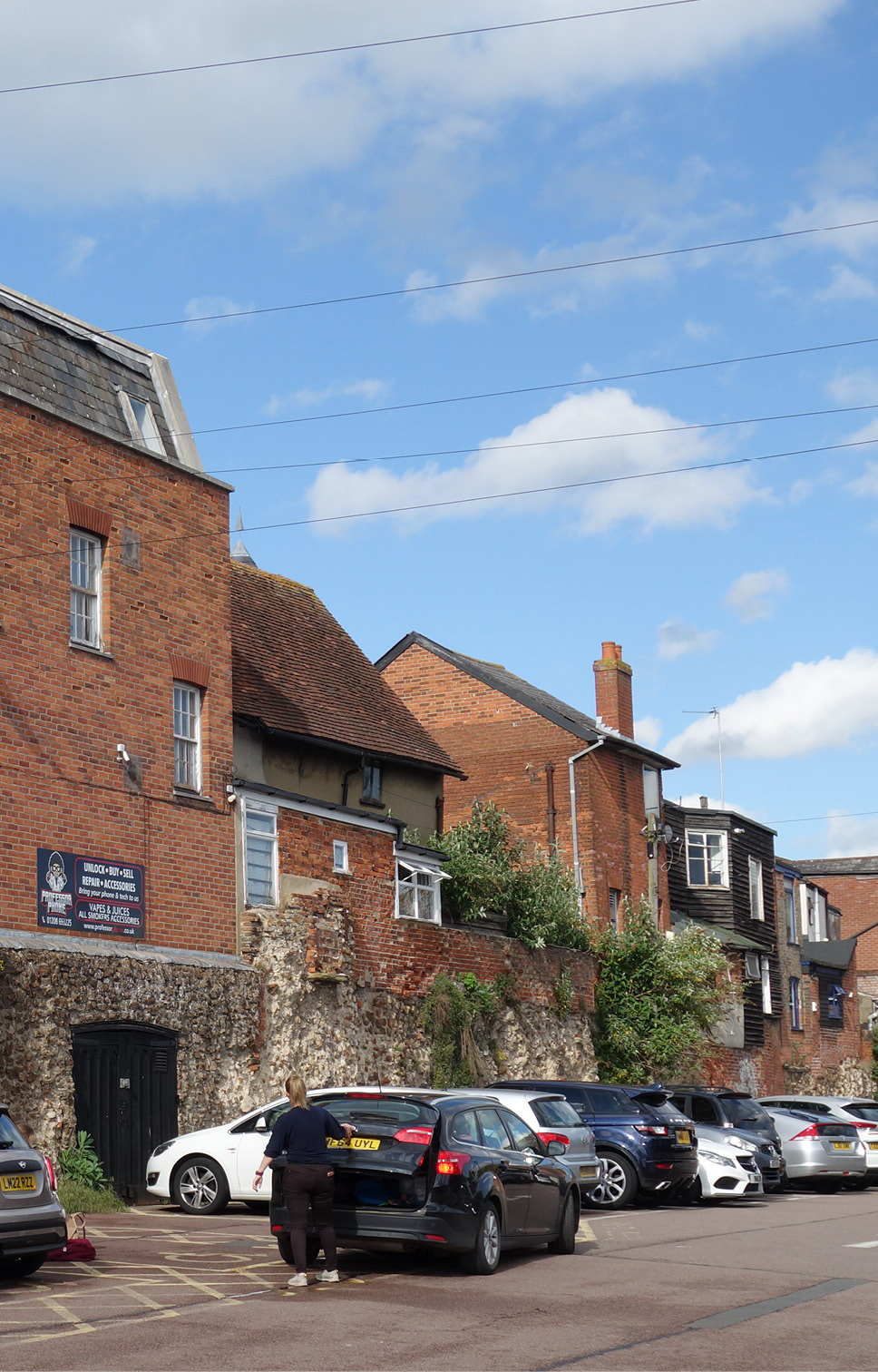 Key Sites
Design frameworks have been prepared for key sites within the city centre that would benefit from either public realm improvements or are one of the city centre’s few redevelopment opportunities.
The key sites are:
- High Street
A low-traffic, people-focused street where space for walking, cycling and outdoor seating is maximised while ensuring necessary public transport, deliveries and blue badge holder access is maintained. - Southway and St John’s Street / Osborne Street
Reconnecting communities to the south into the city centre, through frequent, at-grade crossing for pedestrians and cyclists. Creating a more attractive public realm that can catalyse the development of sites on either side and turn Southway from a ‘back’ to a ‘front’ while keeping traffic flowing. - Former bus station site
Public space and mixed-use development including space for creative and digital industries alongside housing. New public realm for events and casual use, including next to the Roman Wall. - Britannia Yard
A significant new public space that can be used for events, markets and casual use, designed to highlight the extraordinary heritage of St Botolph’s Priory. New urban housing of various types, fully integrated with the existing neighbourhood south of Priory Street. - Vineyard Gate
Public open space next to the Roman Wall, an attractive walking and cycling route through to Queen Street, and fine-grain, tight-knit new homes and business space as infill in and around existing buildings. - St Botolph’s junction
Reclaiming space for people, interchange between different travel modes, and to mend the street frontage to the south of the junction through new mixed-use development.
Key sites 3-6 have been allocated in the Local Plan as City Centre Allocations in Policy TC3.
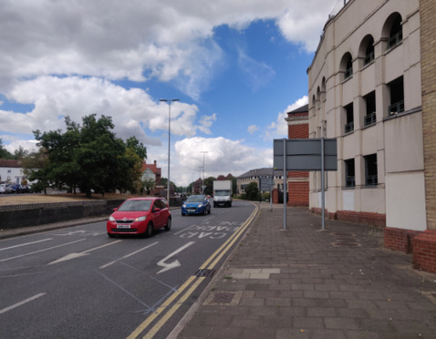
Southway with the Osborne Street NCP car park to the right
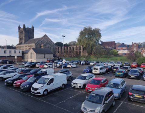
Britannia Car Park with St Botolph’s Church and St Botolph’s Priory in the back ground

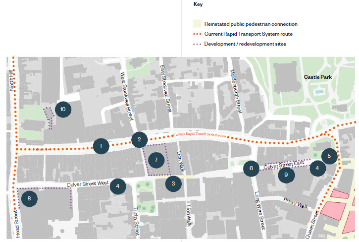
High Street
Planning and Design Framework
The High Street is an arrival point in the city centre for many people, as well as the civic heart of the city. It must be a generously designed place to dwell by day and night, with an active street life.
This design framework also considers Culver Street, an important counterpart to the High Street, as a largely vehicle-free route east-west, and should be considered in tandem with the development of the High Street.
Public realm and connectivity improvements
- Continue to improve High Street as a multi-functional, low-traffic public space which balances the needs of users. For suggested design approaches, see following page.
- Enhance crossing between West Stockwell Street and Pelham’s Lane, improving accessibility of Dutch Quarter as low-traffic, lower-gradient alternative to North Hill for pedestrians and cyclists.
- Seek to reinstate 24 / 7 public pedestrian connection between Culver Street East and West as a long-term aspiration.
- Improve public realm along Culver Street East and West as level surface street with improved lighting and improved pedestrian crossing to Firstsite.
- Improve setting of All Saints Church (Natural History Museum) including increased public access to churchyard green space for informal use.
- Improve wayfinding with high quality signage along High Street and Culver Street East and West.
Trinity Square already has planned public realm improvements including increased public access.
Development / redevelopment sites
- Encourage reuse of vacant department store structure (former M&S) for appropriate new uses, such as indoor market; workspace / co-working space; community uses.
- Ensure new use or redevelopment of former Debenhams site increases active frontages on Culver Street West.
- Improve Culver Street East to create more street level activity, screening service yards with active frontages.
- Secure restoration and conversion of Grade 2 listed St George’s Hall for long-term viable new uses which allow public access.
High Street
Streetscape Design Considerations
A detailed design study for improvements to the highways layout and public realm on the High Street should be undertaken prior to the installation of additional infrastructure relating to the Rapid Transit System. This design study should assess the opportunities for improved sustainable transport along the High Street, particularly in a car-lite city centre environment which could include some limited east-west connectivity. The following design considerations should be addressed:
- Achieving dwell time and making a pleasant pedestrian environment should be the priority on the High Street. Pavement (footway) space should be maximised in order to accommodate more outdoor seating, both public and outside food and drink venues, as well as opportunities for tree planting where feasible.
- To maximise pavement space, bus stops, drop-off bays and on-street blue badge parking should be staggered so that space for vehicles is never greater than the equivalent of two lanes (6m). A further detailed study should be conducted to ensure that sufficient blue badge parking is provided.
- Ensure footway at each end of the High Street is widened for the first 30-40m to avoid loading bays dominating the gateways to the High Street.
- Current footway build-outs and signalled crossings do not generally align with where side streets meet the High Street so are not intuitive for pedestrians - this should be addressed.
- Cycle contraflow (east to west) is challenging to achieve while maintaining loading access from High Street to businesses on the south side of the street. Consider using Culver Street for east-west cycle route.
- Consolidate bus stops into fewer zones as part of rationalisation of bus and RTS services. Bus stops between West Stockwell Street and George Street are located at the widest point along the High Street, so are the preferable location for retaining bus halts.
- Taxi and blue badge parking / drop-off currently on south side of the street which results in passengers exiting into the path of oncoming traffic. Consider use of current loading bay area outside the Town Hall for taxi and drop-off.
- Where businesses do not require High Street loading, footway should be built out to the maximum width. Encourage businesses to use alternative loading access, if this transition is possible.

High Street
Precedent Studies
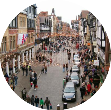
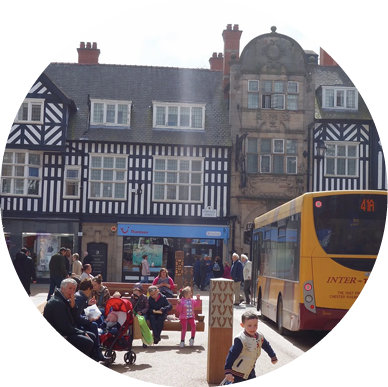
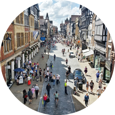
Integration of vehicles into high quality streetscape
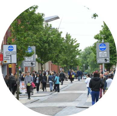
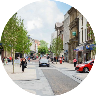
Foregate Street and Frodsham Street, Chester
Design features include:
- Stone surfacing to carriageway raises the visual quality of the space and gives visual cue to vehicles that pedestrians have priority
- Low raised kerb is good for visually impaired user safety and does not intrude visually
- Vehicle access and loading included but in limited locations
- Bus access integrated
- Some areas have no kerb level change at all but very careful design for visually impared users which has resulted in good feedback from this part of the community
Integration of vehicles into high quality streetscape
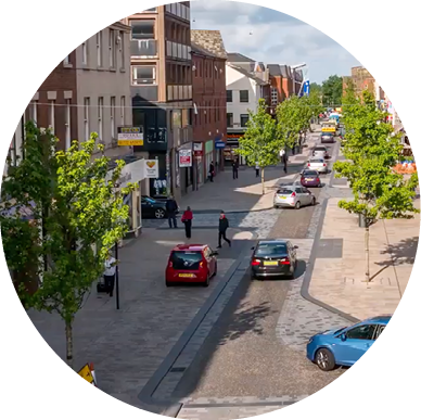
Fishergate, Preston
Design features include:
- Carriageway narrowed to the minimum necessary
- High quality surface materials with good use of colour and texture differentiation to further reduce the apparent carriageway width
- Regular pedestrian crossing points made visually apparent by use of contrasting surfacing
- Low raised kerb is good for visually impaired user safety and does not intrude visually
- Good quality street trees added which will mature to a significant scale, strengthening the urban character of the street
- No bus integration
Photo credit: Planit-IE
Southway and St John’s Street / Osborne Street
Planning and Design Framework
Southway is a barrier for pedestrian and cycle access from southern neighbourhoods of the city into the city centre. It is an unattractive and unsafe environment for all users apart from those in vehicles.
Addressing this severance will have a substantial impact in shifting residents to use walking and cycling to access the city centre, and will ‘unlock’ the development potential of sites either side of Southway.
Public realm and connectivity improvements
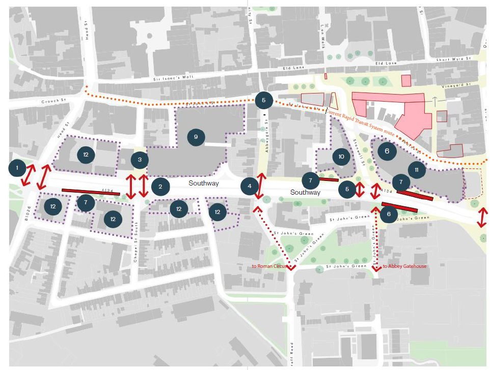
- At-grade signalled pedestrian and cycle crossings at junction with Butt Road / Headgate.
- At-grade signalled pedestrian and cycle crossings between Chapel Street North and South. This could include removing the turn lanes for vehicles turning into Chapel Street South, increasing footway width.
- Improvement to public realm outside Headgate Theatre and up to St John’s Street.
- Signalled pedestrian crossing between Abbeygate and St John’s Green and up to Roman Circus. Likely to require steps and ramp due to level changes, not suitable for cycle use.
- At-grade signalled pedestrian and cycle crossing between Stanwell Street and St John’s Green and up to the Abbey Gatehouse.
- Improvement to bus facilities - refer to City Centre Transport Plan.
- Potential bus / rapid transit stop locations on Southway could potentially be achieved by removing turn / filter lanes.
- Implement high quality wayfinding signage at all junctions (1,2,4,5) and on St John’s Street.
Development / redevelopment sites
The strategic approach is not to seek immediate redevelopment of existing multi-storey carparks due to their embodied carbon value, demolition costs and the continued need for parking for a significant proportion of city centre users and businesses. However, in time, subject to satisfaction of these issues and after modal shift in transport habits, these sites could come forward for mixed use development.
- St John’s multistorey and ground floor retail: Upgrade to form best-in-class parking facility with attractive entrances and street frontage allowing 24 / 7 secure and attractive access for all. Reallocate space, including ground floor units, to include micro-mobility hire; car club spaces; electric car charging; drop-off and pick-up; parcel pickup; waiting areas for delivery drivers. Install PV panel canopy at roof level.
- Stanwell House: Site may have potential to address need for improved bus waiting / layover facilities. If not required for that purpose, retain and adapt existing building to reduce embodied carbon impacts. Structure is likely to be suitable for E class ground floor uses (workspace, retail, cafe / bar / restaurant) with residential uses (compatible with city centre location and proximity to night-time economy activity) above. If extended or redeveloped at higher density, up to 15m to parapet height, with set-back upper storey, would be appropriate.
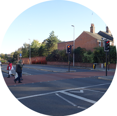
At-grade crossing at the eastern end of Lexden Road by Rawstorn Road
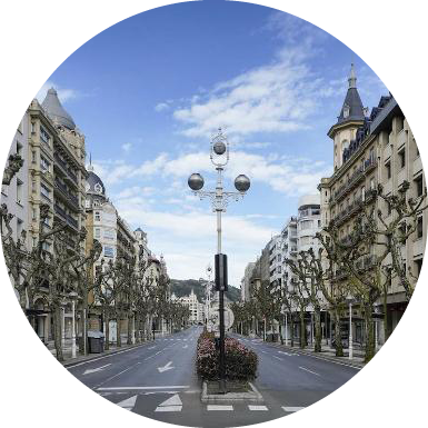
Example of four-lane arterial road with high quality tree planting, public realm and surface crossings
- Osborne Street car park and ground floor bingo hall: Encourage change of use of ground floor space to create active frontages on all sides (retail, food and drink, workspace / coworking, community or cultural uses). Encourage operator to upgrade parking to form best-in-class parking facility including micro-mobility hire; car club spaces; electric car charging; drop-off and pick-up; parcel pickup; waiting areas for delivery drivers; PV
 panel canopy at roof level. Explore moving vehicle entrance to Southway.
 - Sites with potential for intensification / redevelopment to a range of uses. Seek adaptive reuse of existing structures where possible, to reduce embodied carbon impacts. Ensure active ground floor uses (community or commercial) to Southway and to all sites on the north of Southway.
Former Bus Station Site
Design Principles
The former bus station site has been identified as a priority area for regeneration for over fifteen years. Adjacent to important heritage assets and the green space of Berryfields, it is at the heart of the creative and digital cluster created by Firstsite, the Minories, 37 Queen St, the Centre for Immersive Innovation in the former bus depot, and the Curzon. It is also adjacent to the vibrant economy of Queen Street which includes bars and restaurants open late into the evening, as well as a wide range of shops and services serving the diverse communities of Colcheser.
The development of this site should include a wide range of uses at ground floor level while also being suitable for residential uses that are compatible with a vibrant city centre location. Creative and digital uses are encouraged. Public realm at the north and south ends of the site will enhance the setting of Firstsite and the Minories to the north; and the Roman Wall to the south, creating attractive areas for ground floor food and drink uses to spill out.
Movement network

- Improve pedestrian and cycle link from Firstsite to Culver Street East. Consider if no. 15 Queen Street might be redeveloped to improve visibility of Firstsite and more generous entrance to the public realm outside the gallery at this important gateway.
- Ensure intuitive pedestrian/cycle movement from Priory Walk to entrance of Firstsite.
- Pedestrian link being created at the former Bus Depot to be retained and continued, to retain potential new access to Berryfields.
- New fully accessible pedestrian link through the Roman wall from Priory Street, to connect into St Botolph’s Priory and Colchester Town Station.
- Vehicle access to the rear of 1-13 and 37-49 Queen Street, required to be maintained, for accessible parking, deliveries and servicing only. To be strictly controlled for authorised users only and with improved boundary treatments and lighting.
Key
 Listed buildings
 Active frontage and pedestrian links
 Roman Wall
 Pedestrian/cycle connection
 Vehicle access/servicing
Public realm and heritage setting
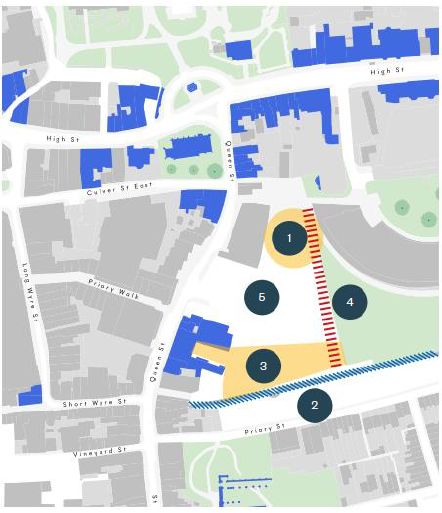
- Expand existing public realm to create larger multi-functional square, ensuring the balcony of the Curzon cinema retains its view of Firstsite.
- Ensure proposals do not cause significant harm to the setting of the City Wall and retain public access along the full length of the wall adjacent to the site, with appropriate landscaping and heritage interpretation.
- Integrate courtyard at the rear of 37 Queen Street into the new public realm while ensuring security and safety.
- Create active frontage and pedestrian link points to Berryfields open green space, to ensure that increased public access and use remains possible in the future, and to ensure an attractive setting to the green space is maintained.
- Public realm design to allow for necessary delivery, servicing and accessible parking requirements without being vehicle dominated.
- Enhance the setting of listed buildings around the site.
Height and massing
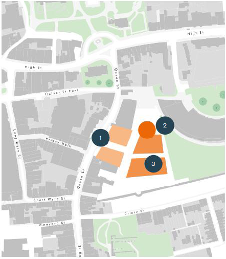
- Frontage to Queen Street to broadly follow existing building heights set by Curzon, Priory Walk and the former Bus Depot development: approx. 12m from pavement level to parapet line. Set-back additional upper storeys may be accommodated with appropriate design and assessment of visual impact on the street.
- Potential for taller building (up to 20m) as a visual landmark facing the public realm outside Firstsite, subject to exceptional design and vertical proportions in order to be seen as an elegant feature in the cityscape.
- Development on the main part of the site to be a maximum of 15m to parapet line. Set-back upper storeys may be accommodated with appropriate design and assessment of visual impact in long-range views, including from Priory Street and St Botolph’s Priory.
Former Bus Station Site
Site Strategy
Use mix
- Active ground floor uses to Queen Street - full range of E class uses would be suitable
- Active ground floor uses to new north-south street - flexible and affordable E class uses with creative / cultural uses preferred such as:
- Affordable workspace for start-up and grow-on businesses in the creative and digital sector
- Space for cultural and creative end-users such as media / film (e.g. Signals Media); live music; independent galleries
- Cafe, restaurant and bar end-users - public realm adjacent to the City Wall, and outside Firstsite /Curzon, to be used for outdoor seating
- Residential upper floor uses suitable for a city centre location, in line with the adopted site allocation policy, and in proximity to night-time economy activity
- All residential uses to be car-free except for provision of on-site blue-badge parking at appropriate ratios - consider an allocation for residents use of annual parking permits to Priory Street car park
- Car club and micro-mobility hire provision on-site
- Secure covered cycle storage, including e-bike lockers and charging points, to be provided at above-minimum ratios
Design and public realm
- Multifunctional public square suitable for outdoor performances and events as well as informal day-to-day use including by young people
- Public realm must be activated by active frontage uses adjacent to City Wall
- Potential visual landmark / taller structure facing square
- New frontages to Queen Street must contribute positively to the varied streetscape
- Positive building frontage to green space
- Servicing and delivery areas to be attractively landscaped to ensure a good setting to Berryfields Park
Related wider area improvements
- Improved public realm on Queen Street including crossings from Culver Street East, Priory Walk and Short Wyre Street
- Roman Wall Park
- Rapid Transit System route
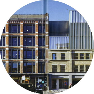
Example of attractive, varied street scene including a range of building scales and architectural
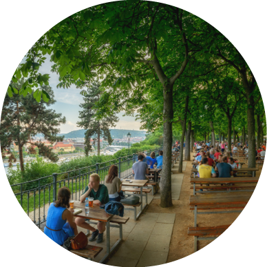
Example of shaded south-facing terraces encouraging active use

Britannia Yard
Design Principles
Britannia Yard has the potential to make a real contribution to the city centre and substantially improve the setting and appreciation of one of Colchester’s most important heritage sites.
St Botolph’s Priory is a spectacular and important site which deserves to be celebrated and widely visited by tourists and residents, but currently suffers from a poor quality setting.
The design strategy is guided by the site of the Scheduled Ancient Monument and uses this to create a high quality public space that can link Colchester Town Station up to Priory Street and beyond. New housing will ‘complete’ the neighbourhood between Priory Street and the railway line.
Movement network

- Ensure clear and intuitive pedestrian and cycle link from Osborne Street into the site including improved crossing over Queen Street.
- New pedestrian and cycle entrance/exit into Colchester Station.
- ‘Quietway’ for pedestrians through St Botolph’s Priory up to Firstsite.
- Create pedestrian and cycle links from St Julian Grove and Nicholson’s Grove.
- Integrated existing pedestrian paths around the north-east of the site.
- Vehicle access and servicing for new development from Queen Street.
- Retain resident parking provision for existing residents and add EV charging points.
Key
 Pedestrian/cycle connection
 Vehicle access/servicing
 Listed buildings
 Scheduled Ancient Monument (SAM)
 Public realm
 Roman wall
 St Botoph’s roundabout
Public realm and heritage setting
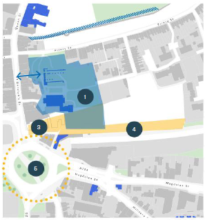
- No intrusive groundworks or building foundations in area of Scheduled Monument - use public realm to help interpret heritage site and improve understanding of its significance. Exact extent of the developable area will be defined by further archaeological evaluation and a Heritage Impact Assessment.
- Consider how better visibility for the western frontage of St Botoph’s Priory could be achieved through redevelopment of unlisted buildings on Queen Street.
- Use public realm to create good visibility into site from Queen Street.
- Use public realm to buffer new housing from noise of railway line.
- Integrate with redesign of St Botolph’s roundabout.
Height and massing
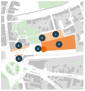
- Mews-style 2-3 storey development on the northern part of site.
- Townhouse typologies of up to 4 storeys / 12m adjacent to Priory Park.
- Mansion block typologies up to 5 storeys / 15m on south part of site - site levels drop down so overall impact of height on long range views is mitigated.
- Articulation of corner could include slightly higher massing or feature, subject to design and view considerations with regard to the setting of the Priory and St Botolph’s Church.
- Create appropriate enclosure and screening of flank walls and service yards.
Britannia Yard
Site Strategy
Use mix
- Active uses fronting new public square, including re-provision of Chinese Community Association premises
- Potential for E class ground floor uses if new development fronting public realm (or shared resident facilities e.g. co-working space, party / event space, shared laundry)
- Potential market function for new public realm, including provision of permanent / semi-permanent kiosks - consider use of railway arches for storage or E class uses
- Potential drop-off and taxi / delivery hub functionality to part of public realm, as part of transport mode interchange
- Residential to ground level except onto square and street, including:
- Terraced family homes
- Family apartments / maisonettes
- 1 and 2 bed apartments
- Independent retirement living
- All residential uses to be car-free except for provision of blue-badge parking at appropriate ratios
- Car club and micro-mobility hire provision on-site
- Secure covered cycle storage, including e-bike lockers and charging points, to be provided at above-minimum ratios
Design and public realm
- Multifunctional public square, integrating heritage interpretation
- Potential arcade / small-scale retail to ‘wrap’ existing buildings
- Positive building frontage to St Botolph’s Priory Park
- Blue badge resident parking, servicing and delivery access
- Private shared courtyard gardens to block interiors, private gardens to terraced housing
- Low rise, high density mews housing
- Contemporary higher-density housing
- Potential long-term opening from Queen Street to Priory, to give greater visibility to the important frontage of the Priory
- Improvements to St Botolph’s Priory Park including additional play provision for all ages
- Retained resident parking for existing residents with EV charging
Related wider area improvements
- Reconfigured St Botolph’s / Southway junction
- Roman Wall Park
- Osborne Street / bus station / NCP reconfiguration and improvement
- Rapid Transit System route / interchange
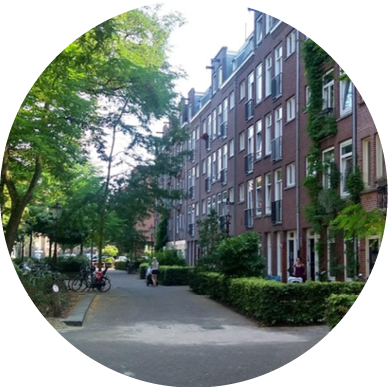
Reference for mansion block scale housing that could be appropriate for the south side of the site
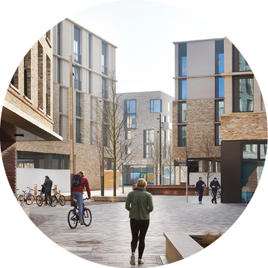
Reference for apartment buildings organised around multi-functional landscaped routes and yards, as suggested for the south side of the site
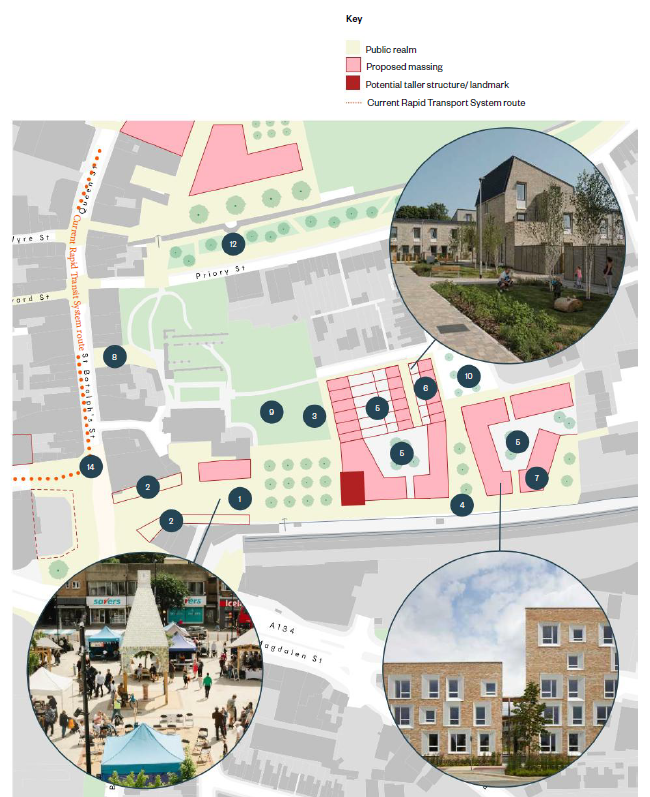
Britannia Yard
Public Realm Scale Comparators
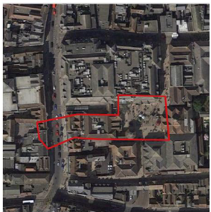
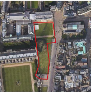
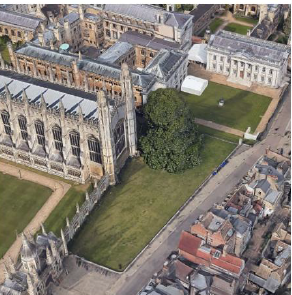
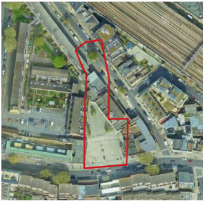
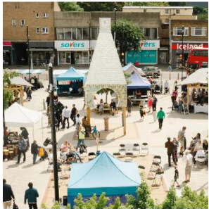
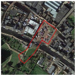
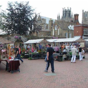
The main part of the public realm proposed in the site strategy is broadly equivalent to Culver Square. This scale of space offers opportunities for a range of uses. The brief and design approach should be explored through the further development of the site masterplan.
Britannia Yard - Public realm as shown on indicative masterplan
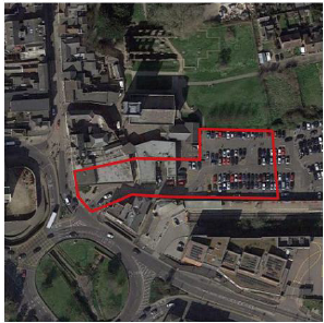
Culver Square, Colchester
Senate House lawn, Cambridge
The Blue Market, Bermondsey
Ely Market Square
Vineyard Gate
Design Principles
Vineyard Gate sites adjacent to the Roman Wall and the remarkable range of buildings above it, which create a unique and memorable vista.
Currently the setting of the Roman Wall is poor and improving this must be a priority for this site, as well as integrating a good quality walking and cycling route from east to west as part of the Local Cyling and Walking Infrastructure Plan.
South of this route, the area traditionally had a tight knit grain of workshops around yards with living accommodation above, and much of this character survives albeit in a poor condition. Development should restore and enhance the best of this character through tight-knit and carefully designed infill development. This can mend the currently ‘gappy’ street frontage to Osborne Street, and create a new, unified frontage to the north facing the new public realm at the foot of the Roman Wall.
Uses should include commercial and residential suitable for an active city centre location.
Movement network

- Key pedestrian and cycle link from Sheregate Steps to St Botolph’s Street along Vineyard St.
- Vertical connection to Lion Walk (replace/refurbish stairs/lift).
- Create north-south pedestrian link connecting Osborne Street to Vineyard Street along Arthur Street (new steps/ramp required).
- Retain servicing access for existing commercial occupiers (with appropriate access control).
- Retain servicing access to Lion Walk undercroft (with appropriate access control).
- Retain short-stay delivery driver waiting area off Vineyard Street.
Key
 Pedestrian/cycle connection
 Vehicle access/servicing
 Listed buildings
 Public realm
 Roman wall
 St Botoph’s roundabout
Public realm and heritage setting

- Improve setting of the Roman Wall and create new high quality public realm alongside the wall. Consider selective demolition to expose the important bastion at the east end of the site.
- Maintain working yard character along Arthur Street but encourage improvements to surface materials and boundary treatments.
- Resurface Vineyard Street as accessible level surface lane (pedestrian and cycle priority).
- Acquire further parking areas at the west end of the site to enable a comprehensive approach to provision of blue-badge and business parking/servicing, including electric vehicle rapid charge points (for commercial vehicles) and regular charging points (for employees).
Height and massing

- Level change from Osborne Street to Vineyard Street is approx. 1 storey.
- Redevelopment and infill along Osborne Street and St Johns Street to a max of 9m to parapet/eaves line along street frontage. Additional set-back upper storey may be accommodated in places with appropriate, high quality design and assessment of context.
- Development at the upper level to be a maximum of 12m to parapet/eaves line. Additional set-back upper storey may be accommodated subject to appropriate, high quality design and assessment of long-range views including setting of Roman Wall.
- Retain and reuse existing buildings, including steel/concrete framed industrial structures, where possible, to reduce embodied carbon costs and retain a varied, characterful development pattern.
- Consider land acquisition to enable further infill development along St John’s Street and encourage redevelopment of low-quality premises along Osborne Street which are reaching end of life.
Vineyard Gate
Site Strategy
Use mix
- Active E class uses at ground level fronting streets and public realm. Due to the development constraints and pattern, units will be small and suitable for independent businesses. Appropriate uses could include:
- Small-scale independent retail
- Cafe, restaurant and bar uses
- Workspace, including workshop/studio space or office space
- Cafe/restaurant uses onto Roman Wall Park to be encouraged.
- Residential upper floor uses suitable for a city centre location in proximity to night-time economy uses and nearby transport interchange. Suitable for 1-2 bed apartments, not family housing.
- All residential uses to be car-free except for provision of on-site blue-badge parking at appropriate ratios. Consider an allocation for residents use of annual parking permits to NCP carpark.
- Car club and micro-mobility hire provision on-site.
- Secure covered cycle storage, including e-bike lockers and charging points, to be provided at above-minimum ratios.
Wider improvements outside the site boudnary should be sought, including to repair and restore historic buildings atop the Roman Wall on the south side of Eld Lane to enhance the setting of the wall and townscape quality.
Design and public realm
- Roman Wall Park to be a high-quality public space including hard and soft landscaping, seating and features encouraging multi- generational use e.g. public chess, table-tennis, boules
- Small-scale mews-style infill/new build to terminate currently untidy flank walls and side yards - may require further site acquisition
- Blue-badge parking and delivery/servicing for existing businesses at the west end of the site including EV charging
- Improved landscaping to Vineyard Street and adjacent parking area
- New steps up from Arthur Street to Vineyard Street, including a ramp if space allows
- Refurbished/reconfigured lift and stairs to Eld Lane - retain as much existing structure as possible to reduce embodied carbon impacts
- Mixed-use, mid-rise dvelopment
- Opportunity for servicing yards to be integrated with public realm
Related wider area improvements
- Osborne Street / bus station reconfiguration
- Improvements to NCP carpark
- Rapid Transit System route / interchange
- Surface crossings to Southway
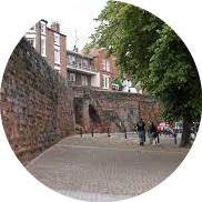
Example of quality public realm and active uses next to historic walls
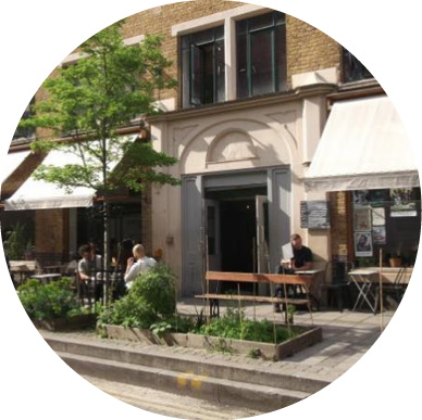
Example of mixed-use mid-rise development

St Botolph’s Junction
Planning and Design Framework
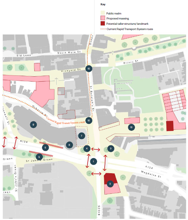
St Botolph’s Junction is an important gateway to the city centre which is currently dominated by traffic and has a poor environment for pedestrian and cycle movement. It does not allow space for modal interchange between transport modes and increases the severance between the New Town neighbourhood and the city centre. Reclaiming space from the junction can create better public realm and enclosure to the space as well as freeing up land for potential built development on the south side of the junction.
- Reconfigure to create an enhanced layout that rationalises the use of space and balances the needs of all road users. Cycle tracks and pedestrian routes to be designed to reflect latest best practice and guidance to promote active travel and well-designed sustainable infrastructure as part of the wider junction reconfiguration.
- Potential new mixed-use development parcel on land reclaimed from highways uses. Suitable for active ground floor E class uses with residential uses above ground. Potential to be a taller building as a visual landmark balancing the Magistrates Court opposite, to a maximum of 20m on the northern part of the parcel, stepping down to 12m to the south.
- Generous public realm at north-east corner of junction providing improved gateway to rail station. Integrate micro-mobility hire and additional cycle parking.
- Integrate tree planting to new and improved public realm, with species chosen to reach large mature heights suited to the scale of the junction (e.g. London Plane).
- Potential bus/rapid transit stop locations achieved through reducing carriageway widths to a consistent two-lane carriageway in both directions (i.e. removing turn/filter lanes).
- Work with car park operator to reconfigure entrance for drivers to be directly from Southway.
- Area to the east of the NCP carpark has potential to be used for bus layover or related facilities, but should present a strong built frontage to the public realm on all sides.
Related wider area improvements
- Osborne Street / bus station reconfiguration
- Improvements to NCP carpark
- Rapid Transit System route / interchange
- Surface crossings to Southway
- Vineyard Gate development site
- Britannia Yard development site
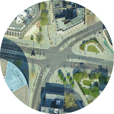
Example of quality public realm and active uses next to historic walls
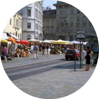
Junction providing modal interchange and outdoor seating in a pleasant environment for all
Indicative New Layout for St Botolph’s Junction
(detailed layout to be subject to detailed design and modelling work)
