Myland & Braiswick Neighbourhood Plan Review
Appendix D
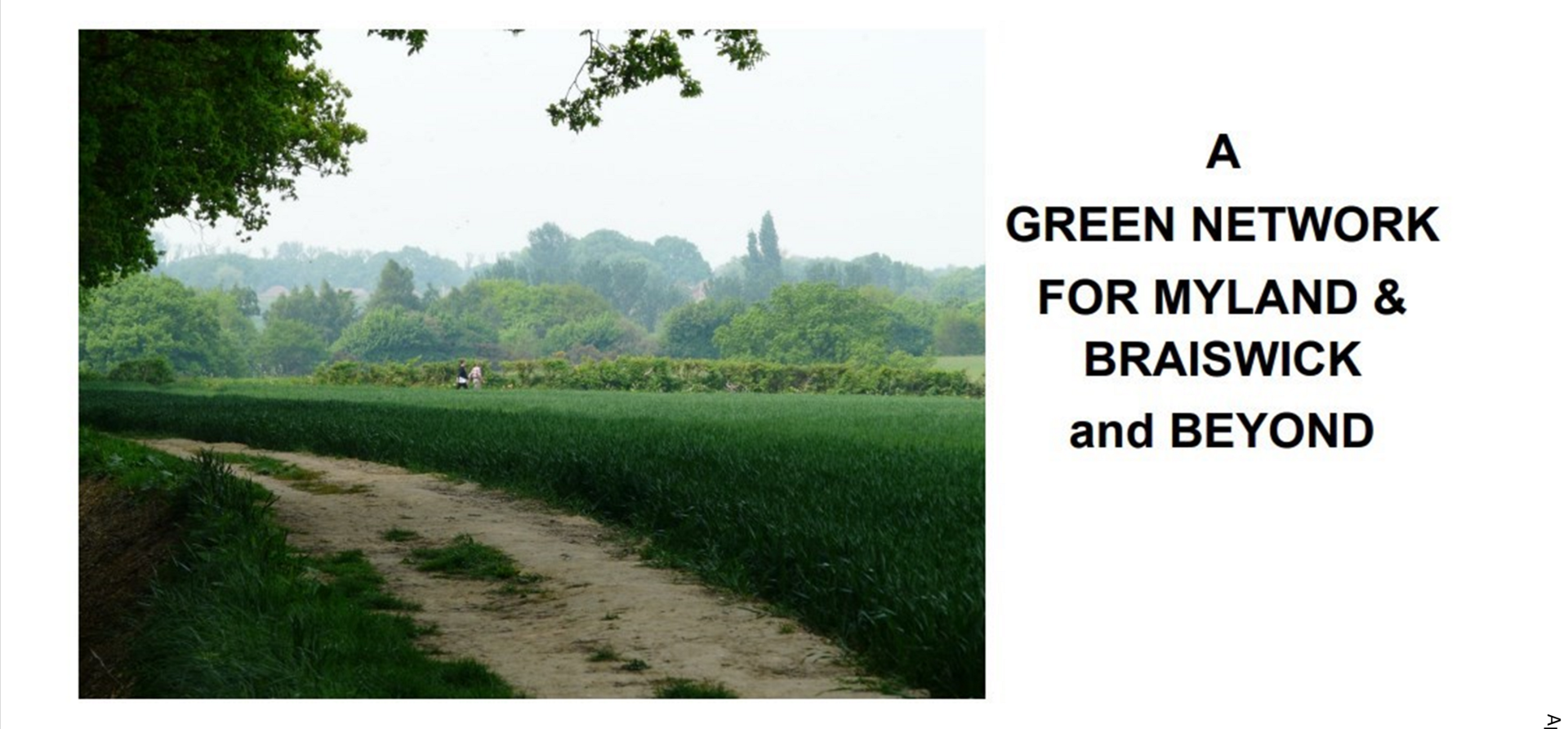
A Natural Green Network for Myland & Braiswick and Beyond
Introduction
Recently there has been an increased focus on the importance of the natural environment, wildlife habitats and biodiversity. The Benefits are seen as important, some would say vital, to both wildlife in conservation terms and to us humans for our health and well-being. This focus has now emerged at UK Government level in the White Paper Planning for the Future and its 25 Year Environment Plan which includes the concept of 'Nature Recovery Networks'.
Britain is reportedly the worst of the G7 nations for protecting flora and fauna. It is reported that 40% of species have declined in Britains in the past 50 years with a 95% loss of wildflower meadows since the 1940's.
We might say that if Government now recognises that action is needed to protect natural habitats then something will happen to improve the situation. However the White Paper referred to above is also determined to make it a lot easier for developers to gain panning permission and build many more houses quicker.
Waiting for Government action to protect natural green space while there is a real threat that more land will be built upon suggests that local actions to be taken now if we wish to protect what is left of Myland and Braiswick green spaces.
Proposals
In outline the proposals are:
- A Natural Green Network should embrace Myland and Braiswick as the latter is a close neighbour and partner in the Neighbourhood Plan.
- All green space is a habitat of some sort and all existing green spaces should be identified that could contribute to the Network.
- The Network should identify green links with the rural hinterland and neighbouring settlements so that green space corridors between settlements can be identified and protected.
- Once identified the Network should be embedded into the Neighbourhood Plan with suitable policies for protection and enhancement.
Benefits
The term 'network' implies connections and this at the heart of the proposals for communities and wildlife. The benefits are:
- Communities will have green links to green spaces that are proven to have major benefits towards our health and well-being.
- Wildlife whether flowers or animals need and will have access to natural space and corridor habitats for living, feeding and breeding.
- Green corridors between settlements protects them from merging into a single urban sprawl and they enable communities to explore green environments and allows wildlife space to flourish.
- The network enables Myland Access Group to deliver access to green spaces.
Identifying Natural Green Spaces
We can identify existing and planned green spaces that should feature in the Network. This is done below by starting with the current and imminent major developments followed by Braiswick and 'other areas'.
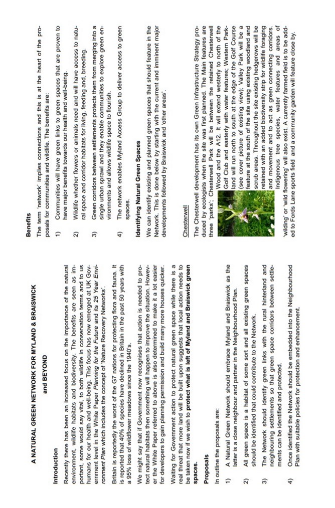
Chesterwell
The Chesterwell development has its own Green Infrastructure Strategy produced by ecologists when the site was first planned. The Main features are three 'parks'. Chesterwell Park will be between the retained Chesterwell Wood and the A12. It will extend westerly to north of the Golf Club and easterly with water features; Western Parkland will run north to south at the edge of the Golf Course (see cover picture of existing view); Valley Park will be a feature at the south of the site using existing woodland and scrub areas. Throughout the site existing hedgerows will be retained with an added biodiversity strip for wildlife foraging and movement and to act as green connecting corridors. Indigenous tree species, water features and areas of 'wilding' or 'wild flowering' will also exist. A currently farmed field is to be added to Fords Lane sports field and a community garden will feature close by.
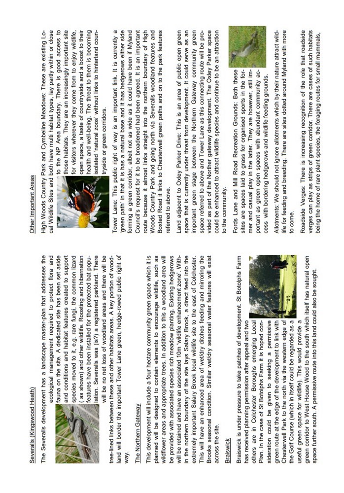
Severalls (Kingswood Heath)
The Severalls development has a landscape master-plan that addresses the ecological management required to protect flora and fauna on the site. A dedicated site has been set aside and conditions and habitat features created to support species moved to it, e.g. rare fungi, the common lizard (as shown) and other wildlife. Roosting and hibernation features have been installed for the protected bat population. Severalls was (is?) a registered parkland. There will be no net loss of woodland areas and there will be tree-lined links between these and other habitats areas. A key portion of woodland will border the important Tower Lane green, hedge-rowed public right of way.
The Northern Gateway
This development will include a four hectare community green space which it is planned will be designed to contain elements to encourage wildlife, such as wildflower areas and appropriate trees. In addition to this a woodland area will be provided with associated species rich meadow planting. Existing hedgerows will be retained and have an associated 10m 'wildlife enhancement zone'. Within the northern boundary of the site lays Salary Brook, a direct feed into the extremely important Salary Brook local wildlife site to the east of Colchester. This will have an enhanced area of wet/dry ditches feeding and mirroring the Brooks seasonal condition. Similar wet/dry seasonal water features will exist across the site.
Braiswick
Braiswick is under pressure to take patches of development. St Botolphs Farm has received planning permission after appeal and two others are in Colchester Boroughs emerging Local Plan. In the case of St Botolphs Farm it is hoped considering could be given to seeking a permissive green route at the edge of the development to link with Chesterwell Park to the north via the western edge of the Golf Course (which in itself could be regarded as a useful green corridor to West House Wood to the south which itself has natural open space further south. A permissive route in this land could also be sought.
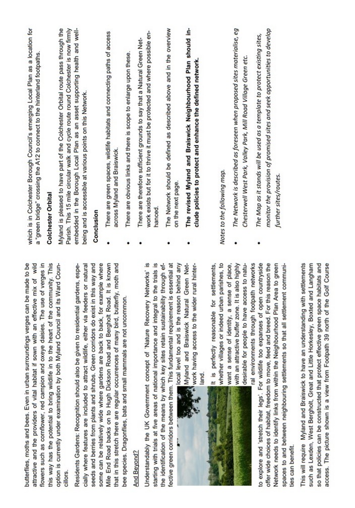
Other Important Areas
High Woods Country Park and Cymbeline Meadows: These are existing Local Wildlife Sites and both have multi habitat types, lay partly within or close to the NP Area boundary. There is good access to those habitats. They are an increasingly important site for visitors wherever they come from to enjoy wildlife, open space, a taste of countryside and a boost to their health and well-being. The threat to them is becoming isolated 'natural zoos' without links to hinterland countryside or green corridors.
Tower Lane: This public right of way is an important link. It is currently a 'green path' in that it has a natural base and it has hedgerows either side forming a green corridor, albeit not as wide as it could have been if Myland Council's request for it to broadened had been agreed. It is an important route because it almost links straight into the northern boundary of High Woods Country Park and going north via Severalls woodland features and Boxted Road it links to Chesterwell green paths and on to park features referred to above.
Land adjacent to Oxley Parker Drive: This is an area of public open green space that is currently under threat from development. It could serve as an important green stage between the Northern Gateway community green space referred to above and Tower Lane as this connecting route will be provided as part of the Northern gateway development. The Oxley Parker space could be enhanced to attract wildlife species and continue to be an attraction to the community.
Fords Lane and Mill Road Recreation Grounds: Both these sites are spaces laid to grass for organised sports in the former and casual play in the latter. They are however, still important as green open spaces with abundant community access with bordering hedgerows and wildlife feeding grounds.
Allotments: We should not ignore allotments which by their nature attract wildlife for feeding and breeding. There are sites dotted around Myland with more to come.
Roadside Verges: There is increasing recognition of the role that roadside verges can play as strips of green corridor. There are cases of such habitats being the home of rare plant species, the foraging routes for small mammals, (continued below)
butterflies, moths and bees. Even in urban surroundings verges can be made to be attractive and the providers of vital habitat if sown with an effective mix of wild flowers such as cornflower, red campion and oxeye daisies. The use of verges in this way has the potential to bring wildlife to the heart of the community. This option is currently under examination by both Myland Council and its Ward Councillors.
Residents Gardens: Recognition should also be given to residential gardens, especially where features are included to attract wildlife, either via deeders or natural seeds and berries from plants and shrubs. Green corridors do exist in this way and some can be relatively wide where gardens are back to back, for example where Mile End Road backs on to Hugh Dickson Road and Bergholt Road. It is known that in this stretch there are regular occurrences of many bird, butterfly, moth and bee species. Dragonflies, bats and small mammals are not uncommon.
And Beyond?
Understandably the UK Government concept of 'Nature Recovery Networks' is starting with trials at five areas of national importance and integral to the trials is the identification of the means by which key sites retain sustainability through effective green corridors between them. This fundamental requirements is essential at local level too and is the reason behind any Myland and Braiswick Natural Green Network having access to the wider rural hinterland.
It is perfectly reasonable for settlements, whether villages or indeed urban parishes, to want a sense of identity, a sense of place, with an attractive buffer zone. It is also highly desirable for people to have access to natural environments through footpath networks to explore and 'stretch their legs'. For wildlife too expanses of open countryside offer wide choices of habitat, freedom to move, feed and breed. For this reason the Network needs to identify links from within the Neighbourhood Plan Area to green spaces to and between neighbouring settlements to that all settlement communities can benefit.
This will require Myland Braiswick to have an understanding with settlements such as Lexden, West Bergholt, Great and Little Horkesley, Boxted and Langham so that policies can be constructed that protect effective green space habitats and access. The picture shown is a view from Footpath 39 north of the Golf Course which is Colchester Borough Council's emerging Local Plan as a location for a "green bridge" crossing the A12 to connect to the hinterland footpaths.
Colchester Orbital
Myland is pleased to have part of the Colchester Orbital route pass through the Parish. This 15 mile circular walk and cycle route round Colchester is now firmly embedded in the Borough Local Plan as an asset supporting health and well-being and is accessible at various points on this Network.
Conclusion
- There are green spaces, wildlife habitats and connecting paths of access across Myland and Braiswick.
- There are obvious links and there is scope to enlarge upon these.
- There are therefore sufficient grounds to say that a Natural Green Network exists but for it to thrive it must be protected and where possible enhanced.
- The Network should be defined as described above and in the overview on the next page.
- The revised Myland and Braiswick Neighbourhood Plan should include policies to protect and enhance the defined network.
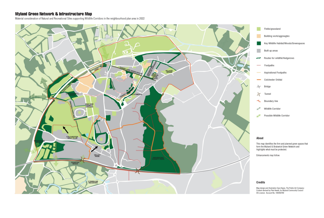
Notes to the following map.
- The Network is described as foreseen when proposed sites materialise, eg Chesterwell West Park, Valley Park, Mill Road Green etc.
- The Map as it stands will be used as a template to protect existing sites, monitor the provision of promised sites and seek opportunities to develop further sites/routes.
ESTABLISHING A GREEN NETWORK TO PORTECT, NURTURE AND ENHANCE MEANS YOU "BELIEVE IN AND CARE ABOUT A WORLD THAT WILL THERE AFTER YOU ARE GONE. IT MEANS YOU HAVE THOUGHT ABOUT MORE THAN YOURSELF, AND THAT YOU CAN IMAGINE A FUTURE BEYOND YOUR OWN LIFESPAN, AND YOU CARE ABOUT THAT FUTURE"
('English Pastoral - An Inheritance', James Rebanks)